


Shady Grove Fellowship Hall, Cherokee County, Alabama
About
Outline

Summary
| Unique Area Identifier | 521345 |
| Name | Shady Grove Fellowship Hall |
| County | Cherokee County |
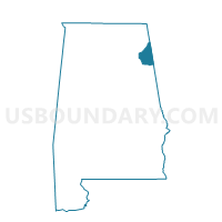
| State | Alabama |
| Area (square miles) | 17.66 |
| Land Area (square miles) | 17.04 |
| Water Area (square miles) | 0.62 |
| % of Land Area | 96.48 |
| % of Water Area | 3.52 |
| Latitude of the Internal Point | 34.13031770 |
| Longtitude of the Internal Point | -85.75542210 |
Maps


Graphs
Select a template below for downloading or customizing gragh for Shady Grove Fellowship Hall, Cherokee County, Alabama


Neighbors
Neighoring Voting District (by Name) Neighboring Voting District on the Map
- Leesburg Volunteer Fire Dept., Cherokee County, AL
- Mt. Weisner Volunteer Fire Dept./Melrose Baptist Church, Cherokee County, AL
- Recreational Outreach Center, Cherokee County, AL
- Union #3 Baptist Church, Etowah County, AL
Top 10 Neighboring County Subdivision (by Population) Neighboring County Subdivision on the Map
- Hokes Bluff CCD, Etowah County, AL (9,279)
- Centre CCD, Cherokee County, AL (8,252)
- Leesburg CCD, Cherokee County, AL (5,561)
Top 10 Neighboring Unified School District (by Population) Neighboring Unified School District on the Map
Top 10 Neighboring State Legislative District Lower Chamber (by Population) Neighboring State Legislative District Lower Chamber on the Map
Top 10 Neighboring State Legislative District Upper Chamber (by Population) Neighboring State Legislative District Upper Chamber on the Map
Top 10 Neighboring 111th Congressional District (by Population) Neighboring 111th Congressional District on the Map
Top 10 Neighboring Census Tract (by Population) Neighboring Census Tract on the Map
- Census Tract 9558, Cherokee County, AL (5,561)
- Census Tract 9559, Cherokee County, AL (4,235)
- Census Tract 106.02, Etowah County, AL (3,984)